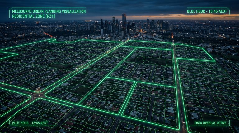
If you’re holding land — or actively assessing sites — in Melbourne’s eastern suburbs, the updated Bushfire Management Overlay (BMO) mapping criteria may have quietly shifted the development potential of your asset. Changes to how the State Government identifies and maps bushfire-prone land mean that sites previously outside the BMO may now fall within it, while some existing overlay boundaries have been redrawn. For developers working across the Dandenong Ranges foothills and the outer eastern municipalities, understanding these changes is no longer optional — it’s a prerequisite for accurate feasibility.
The BMO applies across significant portions of Maroondah City Council, City of Knox, City of Manningham, and the eastern fringe of City of Monash. These are precisely the corridors where medium-density and greenfield development activity has been strongest over the past five years. A site that appeared straightforward under previous mapping may now trigger a mandatory planning permit pathway, additional referral requirements, or construction-cost implications that materially affect your development outcome.
This guide outlines what the updated mapping criteria involve, how they interact with the Victorian planning scheme, which council areas face the greatest exposure, and what practical steps developers may need to take before committing to a site or lodging a planning permit application. For a broader overview of how overlays and planning scheme requirements interact with residential development, see our guide to Fire Safety Building Regulations in Victoria.
Understanding the Bushfire Management Overlay: Core Concepts
The Bushfire Management Overlay is a statutory tool embedded in Victorian planning schemes under Clause 44.06. Its purpose is to ensure that land use and development in areas subject to bushfire risk is planned and designed to protect human life. Unlike some overlays that primarily regulate aesthetics or heritage, the BMO carries hard planning permit triggers and non-negotiable referral requirements to the Country Fire Authority (CFA). For a broader overview of how the Victorian planning system structures these requirements, see our Victoria Planning Regulation: A Comprehensive Overview.
When a site is affected by the BMO, a planning permit is required for a range of uses and developments that would otherwise be exempt — including the construction of a dwelling, subdivision of land, and certain vegetation removal activities. This means a developer who has relied on a permitted use pathway may find that a BMO-affected site requires a full planning permit application, CFA referral, and compliance with the bushfire planning provisions under Clause 52.47 (Planning for Bushfire).
The mapping itself is maintained by the Department of Transport and Planning (DTP) in conjunction with the CFA, using updated fuel hazard modelling, vegetation data, and terrain analysis. The most recent review incorporated revised fire behaviour modelling that accounts for changing climate conditions — resulting in expanded overlay boundaries in several eastern suburbs growth corridors. Developers who last assessed a site’s overlay status more than 12–18 months ago may be working from outdated information.
How the New Mapping Criteria Differ From Previous Versions
The updated criteria represent a methodological shift rather than a simple boundary expansion. Previously, BMO mapping relied heavily on broad vegetation classifications and proximity to known fire-prone areas. The revised approach incorporates more granular fuel hazard assessments, updated satellite imagery, and refined slope and aspect modelling. The practical result is that the overlay now captures some peri-urban sites that were previously considered low-risk based on their proximity to established residential areas.
For developers in the Dandenong Ranges foothills — particularly in areas like Ringwood East, Croydon Hills, Wonga Park, Warrandyte, and the eastern edges of Rowville and Ferntree Gully — this is particularly relevant. These localities sit at the interface between established suburbia and remnant bushland, and the updated modelling has, in some cases, extended the BMO into parcels that adjoin or are surrounded by residential development.
A key change worth noting is the treatment of asset protection zones (APZs). Under the updated criteria, the required APZ dimensions for new dwellings in certain Bushfire Attack Level (BAL) categories have been recalibrated. This affects not just whether a planning permit is required, but how much of a site’s area may need to be designated as an APZ — directly impacting net developable area, setbacks, and ultimately, yield. Developers assessing multi-lot subdivisions in affected areas may find that APZ requirements reduce the number of achievable lots more significantly than previous assessments indicated.
It is also worth noting that the updated mapping criteria interact with the Bushfire Management Statement requirements. Under Clause 52.47-4, a Bushfire Management Statement must accompany planning permit applications for subdivision and residential development in BMO-affected areas. The content requirements for this statement have been updated to align with the new mapping methodology, meaning that statements prepared under the previous framework may no longer satisfy the responsible authority’s requirements.
Council-by-Council Exposure Across the Eastern Suburbs
The degree of BMO exposure varies meaningfully across the eastern suburbs municipalities. Understanding the specific planning scheme context for each council is important when assessing site risk. Developers pursuing townhouse development in Victoria across these corridors should factor council-specific BMO exposure into early feasibility work.
Get the 10-page Site Assessment Checklist Melbourne developers use to evaluate sites before committing capital. Free PDF, instant download.
- Zone, overlay & setback checks
- Dwelling capacity estimation
- Council-specific red flags
Something went wrong. Please try again.
No spam. Unsubscribe anytime.
Check your inbox — your checklist is on its way.

Maroondah City Council
Maroondah has some of the highest BMO exposure of any inner-to-middle eastern suburbs council. Suburbs including Ringwood East, Croydon Hills, Warranwood, and Wonga Park contain significant BMO-affected land. The updated mapping has extended overlay boundaries in several of these areas, particularly on sloped sites with remnant native vegetation. Maroondah’s planning scheme applies the BMO in conjunction with the Significant Landscape Overlay (SLO) in some precincts, creating a compounding permit trigger scenario that developers may need to navigate carefully.
City of Knox
City of Knox presents a mixed picture. The western and central parts of the municipality — Wantirna, Bayswater, Boronia — have relatively limited BMO exposure. However, the eastern portions of Knox, including Ferntree Gully, Upper Ferntree Gully, and Scoresby, contain substantial BMO-affected land, particularly where residential zoning abuts the Dandenong Ranges National Park. The updated mapping has, in some instances, extended the BMO into established residential streets that were previously unaffected, creating potential complications for infill development and subdivision applications.
City of Manningham
City of Manningham’s BMO exposure is concentrated in its eastern and northern precincts — Warrandyte, Warrandyte South, Park Orchards, and Wonga Park. These areas have long been recognised as high bushfire risk, and the updated mapping largely reinforces existing overlay boundaries rather than introducing significant new areas. That said, developers assessing larger rural residential lots in these precincts should verify current overlay status, as boundary adjustments at the parcel level can affect feasibility calculations for subdivision proposals.
City of Monash
City of Monash has comparatively limited BMO exposure, with the overlay primarily affecting the eastern fringe near Wheelers Hill and Rowville where residential development interfaces with remnant vegetation. The updated mapping has introduced some minor boundary adjustments in these areas, but the overall impact on Monash development activity is less pronounced than in the outer eastern councils.
City of Whitehorse and City of Boroondara
Both City of Whitehorse and City of Boroondara have minimal BMO exposure given their established urban character and limited remnant bushland. Developers focused on these municipalities are unlikely to be directly affected by the updated mapping criteria, though sites adjoining significant tree canopy in areas like Nunawading or Mitcham may warrant a precautionary overlay check.
Planning Permit Implications and the CFA Referral Process
For developers, the most immediate practical implication of BMO-affected land is the mandatory CFA referral. Under the Planning and Environment Act 1987, the CFA is a referral authority for planning permit applications on BMO-affected land. This means the responsible authority cannot grant a planning permit without first receiving a response from the CFA — and the CFA’s conditions, if any, become conditions of the permit.

CFA referral typically adds four to eight weeks to the planning permit assessment timeline as a general guide, though this varies depending on application complexity, the completeness of documentation, and council workload. Developers should factor this into project programmes, particularly where financing arrangements are time-sensitive. For a broader view of how referral processes affect overall permit timelines across eastern suburbs councils, see our Planning Permit Timeline Melbourne by Council guide. In SQM Architects’ experience across eastern suburbs projects, early pre-application engagement with the CFA — before lodging a formal planning permit application — can significantly streamline this process.
The planning permit application itself will need to address several BMO-specific requirements under Clause 52.47, including:
- A Bushfire Management Statement prepared in accordance with the current guidelines
- Demonstration of compliance with the applicable Bushfire Attack Level (BAL) rating for the site
- An asset protection zone (APZ) layout plan showing required setbacks and vegetation management areas
- A water supply and access statement confirming firefighting water availability and emergency vehicle access
- Where applicable, a bushfire hazard site assessment prepared by a suitably qualified practitioner
For subdivision applications, the requirements extend further. Clause 52.47-5 sets out specific subdivision design requirements, including lot layout, road design for emergency access, and the provision of communal water supply infrastructure. These requirements can materially affect lot yield and infrastructure costs — factors that need to be modelled into feasibility assessments before a site is acquired. For more on the subdivision process in Victoria, see our guide on How to Subdivide Land in Victoria.
Construction Cost Implications: BAL Ratings and Building Standards
Beyond the planning permit pathway, BMO-affected sites carry construction cost implications that developers sometimes underestimate. The Bushfire Attack Level (BAL) rating assigned to a site — which ranges from BAL-LOW through to BAL-FZ (Flame Zone) — determines the construction standards required under Australian Standard AS 3959 (Construction of Buildings in Bushfire-Prone Areas). For developers pursuing dual occupancy development in Melbourne, BAL rating costs apply across each dwelling and should be incorporated into feasibility modelling from the outset.

Higher BAL ratings translate directly into higher construction costs. The following provides a general indication of cost impact by BAL category. These figures are indicative only, based on general industry benchmarks, and will vary significantly based on design, materials, contractor, and site conditions. Current cost estimates should be obtained from a qualified quantity surveyor:
- BAL-12.5: Relatively modest additional cost — primarily relates to ember protection for openings and roof spaces
- BAL-19: Moderate additional cost — includes requirements for window glazing, external wall construction, and subfloor protection
- BAL-29: Significant additional cost — more stringent requirements for wall systems, roofing, and decking materials
- BAL-40: Substantial additional cost — comprehensive construction requirements affecting most building elements
- BAL-FZ: Major additional cost — the most stringent category, with construction premiums that can be substantial depending on design and size
These figures illustrate why BAL rating assessment is a critical input to development feasibility — particularly for multi-lot subdivisions where the cost premium applies across every dwelling in the development. A 10-lot subdivision where each dwelling attracts a BAL-40 construction premium may see total construction costs increase materially compared to an equivalent unaffected site. Actual costs will vary and should be verified with a qualified quantity surveyor as part of your property development feasibility assessment.
SQM Architects works with clients to optimise site layout and building design to achieve the lowest achievable BAL rating for each lot, within the constraints of the planning scheme and CFA requirements. Thoughtful siting, orientation, and vegetation management planning can, in some cases, reduce the applicable BAL rating — with meaningful cost savings across a development programme.
Practical Steps for Developers: Due Diligence and Site Assessment
Given the complexity of BMO-affected development, a structured due diligence approach is essential. The following steps outline what developers may need to undertake when assessing a site with potential BMO exposure.

Step 1: Verify Current Overlay Status
Do not rely on historical planning certificates or previous due diligence reports. Check the current planning scheme maps via the Victorian Planning Schemes Online portal or request an up-to-date planning certificate from the relevant council. Given the recent mapping updates, any assessment older than 12 months may not reflect current overlay boundaries.
Step 2: Commission a Bushfire Hazard Site Assessment
For sites within or adjacent to the BMO, a bushfire hazard site assessment by a suitably qualified practitioner — typically an accredited bushfire consultant — will provide a site-specific BAL rating and identify the APZ requirements. This assessment is a prerequisite for the Bushfire Management Statement and will inform both planning and construction cost modelling.
Step 3: Engage with the CFA Pre-Application
The CFA offers a pre-application service for complex or sensitive proposals. Early engagement can clarify the CFA’s likely position on a development proposal, identify any site-specific concerns, and reduce the risk of conditions or objections at the formal referral stage. This is particularly valuable for subdivision proposals where lot layout and access design are still being finalised.
Step 4: Model BMO Costs into Feasibility
Update your feasibility model to reflect BMO-specific costs, including: planning permit preparation costs (Bushfire Management Statement, BAL assessment), extended planning timeframes (CFA referral), construction cost premiums (AS 3959 compliance), and any reduction in net developable area due to APZ requirements. A site that appears viable on headline numbers may present differently once these factors are incorporated.
Step 5: Engage an Architect with BMO Experience
BMO-affected development requires an architect who understands both the planning scheme requirements and the construction standard implications. SQM Architects has delivered projects across Maroondah, City of Knox, and City of Manningham with BMO exposure. Early architectural input — including planning drawings prepared to permit-ready standard — can help identify design strategies that manage BAL ratings and APZ requirements without sacrificing development yield.
Frequently Asked Questions
How do I find out if my site is affected by the Bushfire Management Overlay?
You can check current overlay status via the Victorian Planning Schemes Online portal using your site’s address or title details. For a definitive answer, request a planning certificate from the relevant council — this is the most reliable method and reflects the current planning scheme maps. Given recent mapping updates, it is advisable to verify status even if a previous assessment indicated no BMO exposure.
Does the BMO automatically prevent residential development?
No — the BMO does not prohibit residential development. It triggers a planning permit requirement and introduces additional assessment criteria under Clause 52.47 of the planning scheme. Development may still be achievable, but it will need to demonstrate compliance with bushfire planning provisions and satisfy the CFA as referral authority. The viability of development depends on site-specific factors including BAL rating, APZ requirements, and access conditions.
How long does CFA referral typically add to the planning permit timeline?
CFA referral typically adds four to eight weeks to the planning permit assessment process as a general guide, though this can vary depending on the complexity of the proposal, the completeness of the application documentation, and whether the CFA requires additional information. Pre-application engagement with the CFA before lodging a formal planning permit application may help reduce delays at the referral stage.
Can a Bushfire Management Statement be prepared by any consultant?
A Bushfire Management Statement needs to be prepared by a suitably qualified practitioner — typically an accredited bushfire consultant with relevant qualifications and experience. The statement must address the current requirements under Clause 52.47-4 of the planning scheme, which have been updated to align with the revised mapping methodology. Statements prepared under the previous framework may not satisfy the responsible authority’s current requirements.
How does the BMO interact with ResCode for residential development?
ResCode (Clause 54 and Clause 55 of the planning scheme) sets out the standard requirements for residential development. Where a site is also affected by the BMO, the bushfire planning provisions under Clause 52.47 apply in addition to ResCode. In some cases, BMO requirements — such as APZ setbacks or vegetation clearance — may conflict with ResCode standards around landscaping or site coverage. These conflicts need to be resolved through the planning permit application, and the responsible authority will generally give precedence to the bushfire safety requirements.
Does the BMO affect subdivision as well as construction?
Yes — the BMO triggers a planning permit requirement for subdivision of land, in addition to construction of dwellings. Clause 52.47-5 sets out specific requirements for subdivision design in bushfire-prone areas, including lot layout, road design for emergency vehicle access, and communal water supply infrastructure. These requirements can affect lot yield and infrastructure costs and should be assessed as part of subdivision feasibility.
What happens if a site was not in the BMO when I purchased it but has since been included?
If a site has been brought into the BMO through a planning scheme amendment after purchase, the new overlay applies to any future planning permit applications. There is no grandfathering of pre-amendment status for new development proposals. If you believe a mapping change has been applied incorrectly to your site, it may be possible to seek a review through the planning scheme amendment process — however, this is a complex and time-consuming pathway that would require specialist planning advice.
Conclusion: Act on Updated Information Before Committing to a Site
The updated Bushfire Management Overlay mapping criteria represent a genuine shift in the planning landscape for eastern suburbs developers. Sites in Maroondah, City of Knox, City of Manningham, and the outer eastern fringe of City of Monash may now carry BMO obligations that were not present — or not apparent — at the time of previous due diligence. The cost and timeline implications of BMO-affected development are material, and they need to be incorporated into feasibility modelling before site acquisition, not after.
SQM Architects – ABN 32 600 928 390, ARBV Reg. No. 51498
SQM Architects has worked with property developers across Melbourne’s eastern suburbs across a range of BMO-affected projects. Our team understands the specific planning scheme contexts of each eastern suburbs council and may assist you in assessing BMO exposure, preparing planning permit applications, and developing construction strategies that could help manage BAL rating costs across your development programme. If you’re assessing a site or reviewing an existing holding in a potentially affected area, early professional input may help identify risks and opportunities before they affect your project budget or programme.
Book a Strategy Call — contact SQM Architects on (03) 9005 6588 to discuss your eastern suburbs development site.
This article provides general information only. For project-specific guidance, consult with qualified professionals.